


Notice: Time - includes short stops at traffic lights, studying the map, etc.
| Day | 1. |
| Date | 4.9.1999 |
| Mileage | 62 |
| Time | 5:00:00 |
| Average speed | 12 |
| Total mileage | 62 |
At 10:30 a.m. I started my longest bicycle journey so far. I had borrowed a tent from the camp. On the very first day, I forgot again that I had locked my bike and broke the lock. Fortunately, my bike was OK, so I could keep going. Thank God.
I slept near Bingham, by Road No. 16.
| Day | 2. |
| Date | 5.9.1999 |
| Mileage | 54 |
| Time | 5:20:00 |
| Average speed | 10 |
| Total mileage | 116 |
I was invited for breakfast in the morning. I only had some water and then had to climb a very steep hill. It was perhaps the toughest one so far. By evening I reached the Moosehead Lake Region - one of my main targets.
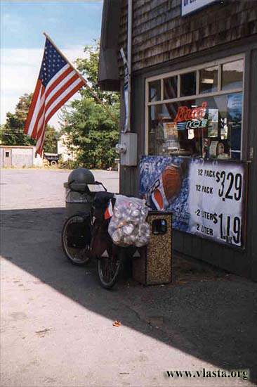
I was inspired by an article about collecting cans. It was not a bad way to make some money, but not every shop accepted them, so I did it only once. I made $2.75 in no more than five minutes.
| Day | 3. |
| Date | 6.9.1999 |
| Mileage | 21 |
| Time | 1:47:00 |
| Average speed | 11 |
| Total mileage | 137 |
I climbed Big Squaw and visited Greenville in the morning. Later that day, I swam in View Pond. This pond was much smaller than Moosehead, so the water was quite warm. I was completely alone there.
| Day | 4. |
| Date | 7.9.1999 |
| Mileage | 45 |
| Time | -:-:- |
| Average speed | - |
| Total mileage | 182 |
It was cloudy almost the whole day. It looked like "Šumava" in the rain. I was going to visit Gulf Hagas, which is called the "Grand Canyon of the East". But after cycling about 12 miles, I was stopped at the gate. Cars were allowed to go another 6 miles to a parking lot, but I was not allowed to continue by bicycle. So I had to turn back.
| Day | 5. |
| Date | 8.9.1999 |
| Mileage | 52 |
| Time | 5:12:00 |
| Average speed | 10 |
| Total mileage | 234 |
After a rainy night, it was a sunny day. I stopped at Lily Bay State Park, which is situated on Moosehead Lake. My next stop was Kokadjo. I saw maybe six people in this village, but half of them were tourists. Just beyond the village was the end of the paved road. To the north, there was only an unpaved private road. This road was open to the public, but paper company vehicles had the right of way. They were hauling timber, and bicycles were prohibited on the "Golden Road". But I only found this out after I was already on it.
I was told that I would see lots of moose along this road, but I kept missing them.
| Day | 6. |
| Date | 9.9.1999 |
| Mileage | 10 |
| Time | |
| Average speed | |
| Total mileage | 244 |
I slept by an artificial lake and in the morning I visited a hunter's cabin. I saw two bears that had been killed the previous night. I stopped at the border of Baxter State Park. I left my bike at Abon Pines. This camp is by the "West Branch Penobscot River". A night costs $5, but I had a 20% discount because of my Maine ID. The camp does not have water (except for the river), and you only have to pay the rancher if you meet him.
Just 15 minutes after I walked into the park, I suddenly met a Black Bear. I was surprised and did not have my camera ready. He was only about 25 feet away, and I did not dare make any noise. He was eating some roots and seemed not to pay any attention to me.
| Day | 7. |
| Date | 10.9.1999 |
| Mileage | 0 |
| Time | 0 |
| Average speed | 0 |
| Total mileage | 244 |
It rained in the morning, but later it became partly cloudy. Hikers and bikers did not have to pay the park entrance fee. I hiked about 12 miles along the Appalachian Trail. I saw a moose on the other side of a pond - pretty far away. Heavy rain started in the afternoon. I met Katty & Ron from Pennsylvania, who gave me a lift back to my camp. It rained for the rest of the day. I had to wait another day to climb Mt. Katahdin.